I’m excited to announce the latest release of geoparquet-io, version 1.4.0. We’ve been making bursty progress since launch, mostly driven by the real world needs of Portolan (specifically portolan-cli). We’ll soon be talking about that project a lot, but from the perspective of geoparquet-io it’s served as a natural place to put many things that felt beyond the scope of what reasonably fit in the geoparquet-io library. And the portolan-cli in turn has driven a ton of improvements into gpio, as it’s been used to convert a bunch of diverse real world datasets into well-formatted geoparquet.
Since geoparquet-io 1.0
We haven’t talked much about geoparquet-io since the 1.0 release, so I’ll start with this section summarizing what has been done from 1.0 to 1.3. There were over 60 PRs across numerous modules, improving the overall quality and reliability with many minor fixes and improvements. Some of the major areas of improvement included:
- Better support for s3 compatible storage, adding write capabilities to non AWS s3 to complement the reading options that came earlier. This enables data to be written to open source aws alternatives like minio, or sovereign s3 implementations like hetzner (#430). So gpio can now easily be a tool to read and write geoparquet to any s3 data source (along with gcp and azure directly) — see S3-compatible storage in the docs.
- Improved WFS support - added WFS 2.0, along with ‘tiling’ strategies that let you pull down a complete dataset from WFS even if there are limits on how much you can page a request (#502).
- GeoArrow geometry types read & write - we initially didn’t support geoarrow native types in geoparquet, as they never were widely adopted. But they do serve some nice niche use cases, and are often used in high-performance systems that have end-to-end control over the data types. So version 1.1 GeoParquets using the GeoArrow geometry types now work well with geoparquet-io (#519), and
gpio convertcan produce native GeoArrow from any input. - ArcGIS Server improvements - these were mostly a set of improvements to handle more types of data and more real world services, driven mainly through portolan-cli working on mass converting full catalogs of ArcGIS Server data.
- Vecorel and fiboa support - these are two emerging standards that came out of the Fields of The World project, and they standardize agricultural field boundaries (fiboa) and provide a more generic way to standardize other columns. geoparquet-io will now always preserve their metadata on input and output, and there is a fiboa plugin to enable easy writing of that format.
- Carto support - it’s now easy to extract data from any Carto endpoint and transform it into GeoParquet with geoparquet-io (#449).
New in 1.4.0
For 1.4.0 I’m pleased to share that we had three new contributors, and saw more users report key bugs.
Top of the list is Cayetano Benavent, who was putting geoparquet-io through its paces creating Portolan catalogs from ArcGIS Servers. One of the nicest improvements he added is the ability to handle different types of curves. DuckDB (our core engine) can’t handle the curves natively, so instead we’ll translate it into a line or polygon equivalent, performing an approximation (#647, streamed rather than materialized in #650) — see Curved Geometries in the docs. He added ten PRs in total, including fixes for nulls and reprojection across CSV and GeoJSON conversions.
Stefan Ekehaug had a couple nice bug fixes (#627), and then just yesterday submitted Sort Tile Recursive (STR) sorting (#766) as an alternative to Hilbert sorting. Kanahiro Iguchi did some great benchmarking on spatial sort algorithms for GeoParquet and found that STR did the best in terms of spatial locality and remote query performance, so I’m excited that it’s now super easy to sort any GeoParquet file to STR with gpio.
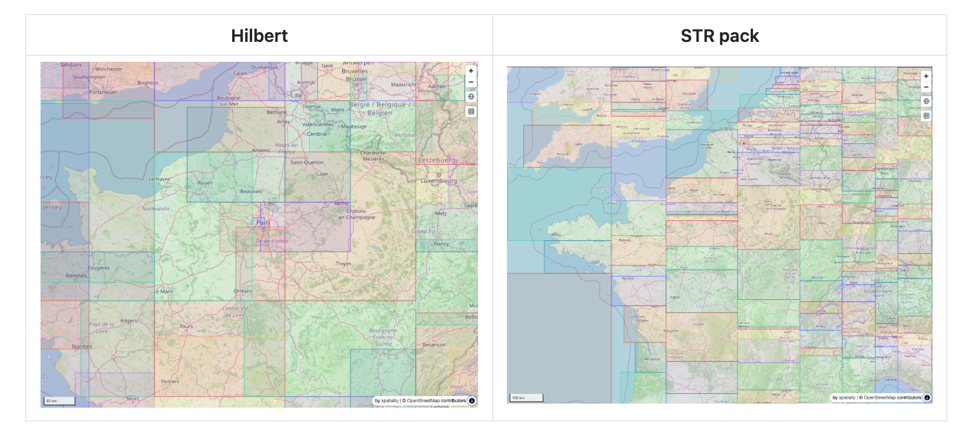
And then Sanjay Santhanam fixed duckdb spatial installation errors (#605), ArcGIS error reporting (#606) and empty geometry bbox issues (#590).
Nissim, my geoparquet-io co-maintainer, came through in force again with 29 PRs, including many improvements to our WFS support, PMTiles output and numerous bug fixes and nice refactors.
As for myself, many of my changes came from building the Fields of the World Portolan Catalog. I’ll talk more about that whole process in a separate blog post, but it’s a truly global dataset with over a billion rows of data. It really stretches the tooling, and it was satisfying to hack things together to get it working with DuckDB and then circle back and improve the core geoparquet-io library to make it easy for anyone (including me) to do similar processing in the future.
There were a number of improvements to better enhance and partition data. The clearest ‘feature’ that I added was the ability to process ‘aggregates’ of a given dataset (#529). You can select which columns you want to aggregate, and then produce new geoparquets that show the summaries of the columns.
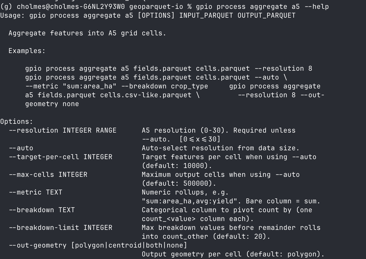
So you can do a call like:
gpio process aggregate a5 buildings.parquet cells.parquet --auto \
    --metric "avg:height,max:height" --breakdown roof_material
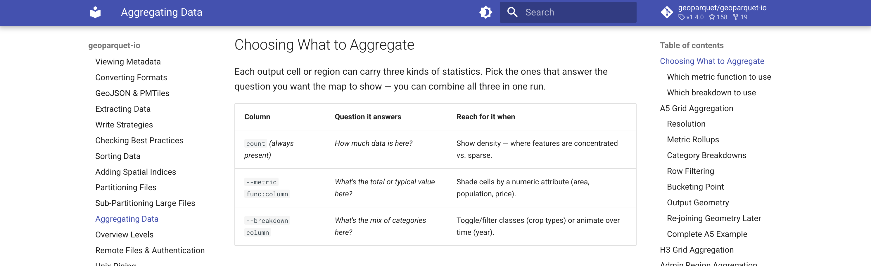
And you’ll get an a5 grid with columns for the average height in that cell, the max height in that cell, and a set of counts for each roof material that is in that cell. This allows you to do full visualization of different aspects of the data. See the Aggregating Data Guide in the docs for a full explanation of all the options and when to use them.
The aggregates can be ‘stacked’ in different zoom levels for global datasets, to make it easier to really see where the data is (#615, which also added gpio pmtiles pyramid to bake the whole stack into one archive):
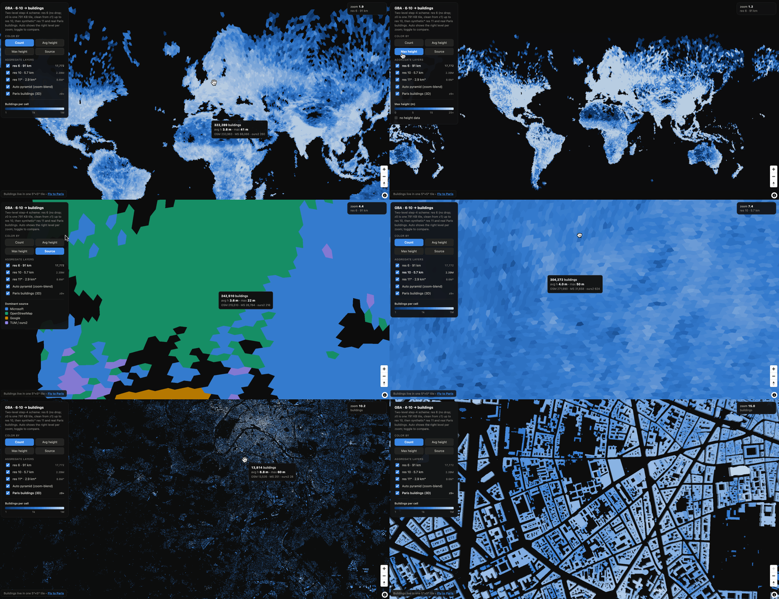
I find it nicer than just thinning features, the default behavior with tippecanoe, as you can’t really get a full sense of the data. This lets you visualize any of the columns you chose to aggregate - above you can quickly see the counts, the max height, the average height and also the ‘source’ of the data.
I don’t yet consider the feature fully ‘done’ - I want to get to a couple simple high level commands that will do a complete aggregation with no input. I have some --auto flags in there, but I’m not yet fully satisfied that they make great results in all cases. I have a suspicion that for global datasets that it may be better to just reuse some consistent ‘steps’ of aggregation levels, and I want to explore that idea a bit more. But I think the added commands will certainly be useful as they are now. It also led to adding a new gpio process command group, and I hope we can enhance it with more cool processing.
In my testing of the aggregation, I also realized that our partitioning in geoparquet-io didn’t work with different CRSs. I was testing aggregation of Dutch Kadaster Buildings, and since aggregation uses the same underlying code as partitioning, it didn’t work at all. So with PR #530 we can now partition or aggregate data in any projection.
The other major project I took on was to improve our core testing infrastructure. On my Claude Max plan I had a good bit of extra Fable credit at the end of the week, so I asked about things we could improve to make this a truly exemplar open source project.
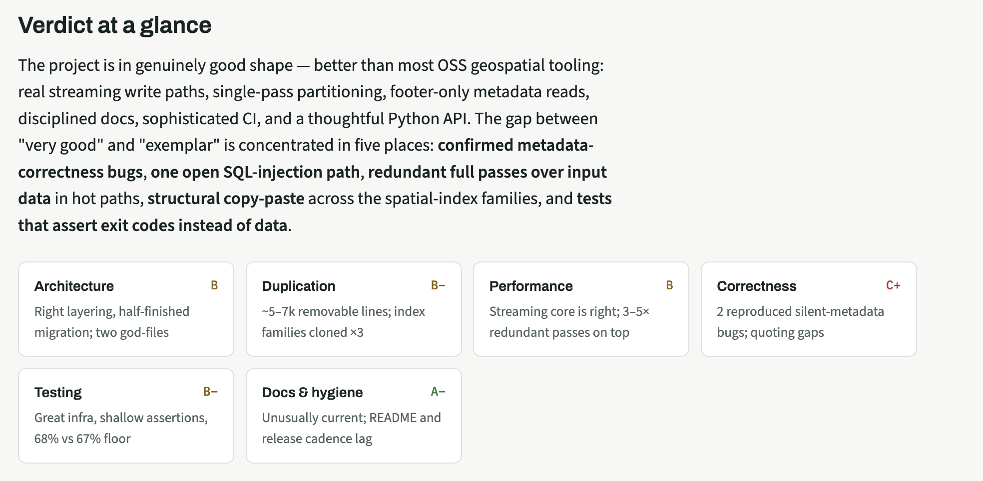
It came up with a nice plan that I think will serve as a roadmap for improvements over the coming months. But it suggested some things that are fairly big swings, so the first thing I wanted to do was improve our testing so that we can have more confidence before doing any refactoring. So for 1.4.0 we’ve mostly fixed key bugs and landed improvements to our test suite. There are now tests to ensure that the python API and the CLI always stay in sync. This surfaced some small ways that they had diverged. This technically introduced a ‘breaking change’, as any change to the API that would make existing code not work right is breaking. But we evaluated the changes and they are all quite minor, mostly just the defaults of a few functions, so we decided that was not worth calling this ‘2.0’. You can read more details in the PR.
We also added a full ‘e2e’ (end-to-end) suite of tests, to better test real user journeys. And we connected all the docs examples to be real test examples, so they are guaranteed to work and raise errors if things break. These changes in turn identified a number of bugs, and a majority of those have been fixed, though I still have some more I’d like to do in the next release.
So we hope you like the release! I feel like we’ve now had enough usage and bug fixes / improvements from real world experience that I’m confident recommending it to anyone. And I suspect we’ll have a steady stream of improvements as Portolan starts to spread, as it’s going to lead to more usage, since there’s a ton of data to convert to geoparquet, and we want geoparquet-io to be the go to tool for any conversion (though we are also quite happy for people to use DuckDB, GDAL/OGR or really any other tool as well 🙂)